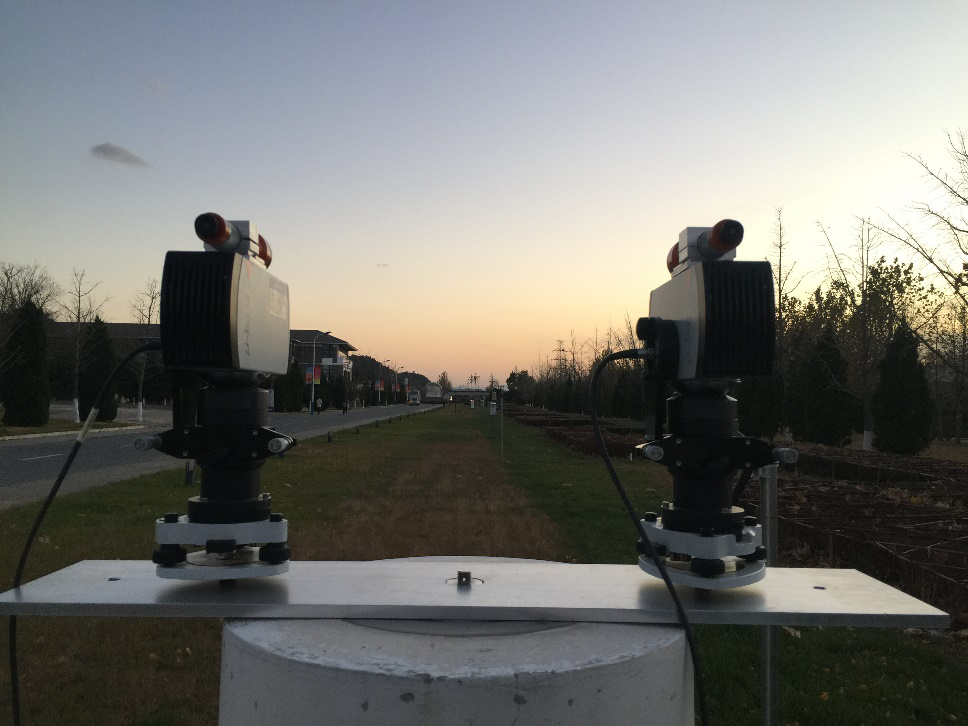
The field baseline is a large-scale dimensional measurement standard for calibrating geodetic instruments such as electronic distance measuring device, rangefinder and GNSS receivers. It plays an indispensable role in the construction of large-scale facilities such as surveying, seismic monitoring and high-speed railway. For decades, China has been using the former Soviet method, according to which the field baseline is calibrated by manual measurement with the 24-meter invar wire, therefore it is very difficult to decrease the relative measurement uncertainty under 1×10⁻⁶.
After years of research, NIM adopts dual high-precision laser rangefinder as the main standard and arranges the environmental parameter sensor array in the measurement path, reducing the uncertainty of the invar wire itself and the impact of environmental parameters on manual measurement. Combined with the innovative method of alternating measurement by dual range finders, NIM successfully reached the measurement uncertainty of 0.5mm per kilometer in the 1.2km standard baseline, reaching the advanced level worldwide. NIM has been applying the mentioned measuring methods to calibrating dozens of standard baselines in local metrology institutes of Zhejiang, Fujian, Shanghai and so on. This method improves the baseline calibration measurement technology and the baseline facilities in China. It meets the calibration requirements for large-scale precision measuring instruments in the fields of aerospace, surveying and mapping, engineering construction, and reservoir dam seismic monitoring.